10 Common Navigation Mistakes New Hikers Make in the UK (and How to Fix Them)
Most navigation mistakes are quiet ones. You take the wrong fork on a bridleway, the path fades into a block of forestry, and an hour later you're standing on a hillside in cloud, wondering whether the ridge in front of you is the one you think it is. Nothing has gone badly wrong yet, but the confidence has drained out of the day. Nearly every error new walkers make on UK hills has a simple, correctable cause, and none of them require you to memorise the whole of the British National Grid.
A phone with a mapping app is a superb tool. It is also a glass rectangle with a battery that dislikes cold, and UK valleys are very good at swallowing signal — which is a problem when the app hasn't cached the tiles you need.
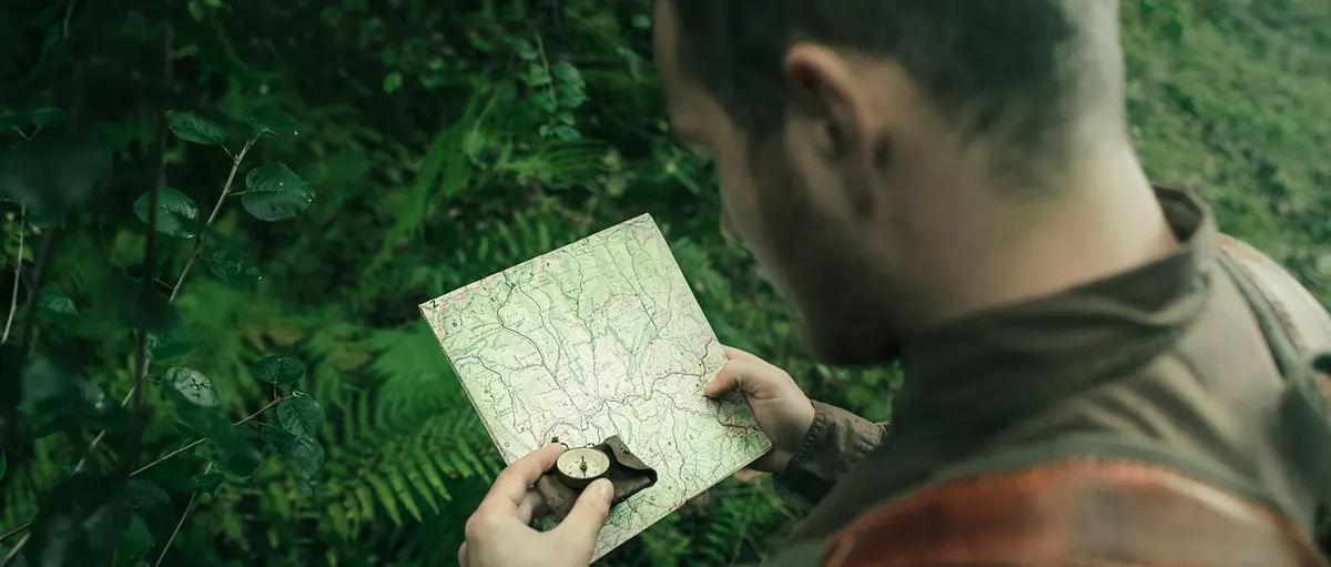
Carry a paper map of the area at 1:25,000 and a compass you've actually held before. Before you leave, download the offline tiles for the whole route, put the phone into flight mode to slow the battery drain (GPS still works), and keep it in an inside pocket where it stays warm. A small power bank weighs very little. If your only map dies at the top of a hill, you have no map at all.
Ask a new walker where they are and they'll often point somewhere vague in the middle of the sheet. The fix is to keep the map set: rotated so that features on the paper line up with the ground in front of you. If the valley falls away on your left and the crag sits ahead, the map should show the same arrangement.
Rest your thumb on your current position and move it as you pass each feature — a gate, a stream junction, a bend in the wall. It sounds fussy, but it means you always know roughly where you are, so the moment you don't, you notice immediately rather than twenty minutes later.
Look behind you, too. Familiar ground looks entirely different from the other direction, and the return leg is where most people come unstuck.
The UK uses the National Grid, and the numbers always run eastings first, then northings — along the bottom before up the side. Swap them and you've confidently sent yourself to another part of the country.
In an emergency a six-figure grid reference straight off your own map needs no signal and no clever app to work. Some teams also accept what3words, but the grid reference is the reliable common language.
Two skills get muddled: turning a direction on the ground into a bearing on the map, and turning a line on the map into a direction to walk. The second is what you need most often, usually to cross featureless ground or pick up a path in mist.
Then watch for interference. Gates, wire fences, cars, a phone in the same hand and magnetic clasps on a map case will all pull the needle. Step away, let it settle, start again. In most of Britain the difference between magnetic and grid north is only a degree or two, so a day walk rarely needs a correction — but it's marked in the map legend and worth understanding before you head somewhere bigger.
Paths are diverted, stiles rot, woodland is felled and replanted, and a right of way on paper can be a wall of gorse in practice. If the ground and the map disagree, don't assume you're the one who's wrong.
Navigate by shape and feature as much as by line.
Ridgelines, the meeting point of two streams, a spur falling away to the left, contour lines bunching as the ground steepens — these change far more slowly than a path or a fence. If the path vanishes but the wall corner it was heading for is still there, walk to the wall corner.
Hill distance takes far longer than pavement distance. A useful rule of thumb is roughly 4 to 5 km an hour on easy ground, with half an hour added for every 300 m of ascent — then more for bog, gates, stiles and a proper lunch. Set a turn-around time before you set off and stick to it, especially in winter when daylight goes early and goes fast.
Compare your actual time with your estimate at every obvious landmark. If you're consistently slower than planned, shorten the route rather than pressing on. And tell someone at home your route, your start time and when you expect to be back. If you need help, dial 999, ask for the police, then ask for mountain rescue, and give your grid reference and a description of what you can see around you.
Two techniques pay for themselves immediately. The first is aiming off: heading for a bridge over a stream, deliberately aim a little to one side, so when you reach the water you know which way to turn. The second is choosing a catching feature — a wall, a road, a river or a ridge — that will stop you drifting too far if you go off line. Handrails work the same way: walk alongside a stream, fence or field boundary and let it do part of the job for you.
Have an escape route in mind for each leg as well. Knowing you can drop off the ridge to a road or a valley track turns a worrying afternoon into a slightly longer one.
Before you set off: map set, route understood, turn-around time agreed, someone at home knows the plan. Then every twenty minutes or so, and whenever the ground changes underfoot, do three things — check the map, move your thumb, and look at the shape of the land to confirm it matches what you expected.
That habit costs almost nothing and catches nearly every error while it is still small. Two things speed up the learning: a short navigation course or a day out with someone more experienced, and regular practise on a familiar local path in poor weather, so that taking a bearing becomes dull. Dull is exactly what you want when the cloud comes down.
Photo: jonassanislo / Pixabay
Previous Post
Walking Boots vs Trail Runners: Which Is Better for British Hill Paths?
Next Post
Beginner's Guide to Your First Solo Hike in the Lake District