Trail Markers and Waymarking in the UK: A Beginner's Guide to Reading Them
The first gate is easy. A yellow arrow on a wooden disc points left, and you follow it. Two hundred yards later the path forks at a stand of gorse, and nothing tells you which way to go. You stand there, map in hand, wondering whether you've missed something.
You probably have. It's likely small, half-hidden behind a branch, and faded to the colour of weak tea. Waymarking in the UK is a quiet, patchy system, put in place by different people over decades, and it rewards a bit of familiarity. Here's what you're actually looking at.
A waymark is any deliberate mark that tells you where a route goes: an arrow on a post, an acorn stencilled on a gate, a dab of paint on a rock. It's guidance, not law.
Separate from that are the signs at junctions that name the right of way and where it leads. In England and Wales these are the responsibility of the local highway authority — the county or unitary council — because they identify public rights of way. So you'll often find an official fingerpost at the point where a path leaves a road, and then little but the odd painted arrow for the next two miles.
Both are useful. The fingerpost tells you what kind of route you're on. The small arrows keep you on it.
If you see an acorn — stencilled, or on a disc with a route name — you're on a National Trail in England or Wales. The South West Coast Path, the Pennine Way, Offa's Dyke Path and the England Coast Path, which is opening in sections, all use it. Markers generally appear on gates, stiles and posts at points where the route turns or crosses something.
First, the acorn doesn't appear in Scotland. Scotland's Great Trails — the West Highland Way, the Southern Upland Way, the Speyside Way and others — each have their own emblem, and the Wales Coast Path has its own branding. Scottish access works differently from England and Wales, so signs there are more about guidance than permission. Second, on any long route the acorn appears less often than you'd like. It marks decisions, not every step.
In England and Wales, the colour of the arrow tells you who the path is for. This is the single most useful thing to learn.
These turn up as plastic or metal discs nailed to posts, painted arrows on gates, and sometimes small plaques set low on a wall where a path squeezes between houses. The arrow shows direction; the colour tells you the status. If you're walking a footpath and see blue, you've strayed onto a bridleway — not a problem in itself, but you've probably missed a turn.
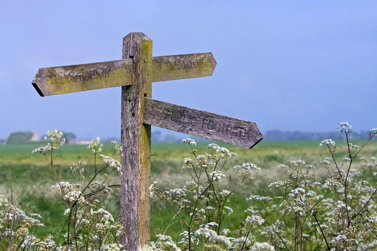
Traditional wooden fingerposts are a pleasure, and most of them still work. Give your attention to three things: the words at the top (public footpath, public bridleway, byway), the destination names, and the distances, usually in miles.
Some fingerposts are old, and a name or distance may reflect a path that was diverted years ago. Where a sign and the ground disagree — a fingerpost pointing at a fence with no gap in it — trust the ground and check your map. Where the sign and the map disagree, trust the map, then look for a waymark. Metal signs fixed to gates are common on farmland, and they're often more current than the wooden post beside them.
Away from the signposted network, the marks get more local and more varied:
And some famous routes are barely waymarked at all. The Coast to Coast, for instance, relies far more on map reading and a decent guidebook than on discs nailed to gates. Don't assume a route is marked simply because it's well known.
It happens on almost every walk, and it's rarely a disaster. Work through it in order:
If you've gone a few minutes on a waymarked route without seeing anything, that's your signal to slow down rather than push on.
Read the waymark before you need it. At every junction and gate, glance both ways and note where the arrows point. Then walk on with purpose.
Say the colour out loud if you're unsure — "yellow, so footpath" — and check it matches the map. Photograph the marker at the start of a diversion or a genuinely confusing junction; it's faster than scrolling back later. Carry a paper map or a downloaded offline map rather than relying on signal-dependent apps. Waymarking and mapping disagree often enough that you want both.
And take a moment to appreciate the acorn on the gate. Someone painted it, and it was probably raining at the time.
Photo: No-longer-here / Pixabay
Previous Post
How to Plan a Car-Free Day Hike on the South Downs Way
Next Post
The UK Hiker's Three-Season Layering Checklist for Changeable Weather